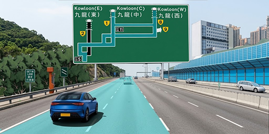
Left Figure: Keep left at the diverging point for "Kowloon (C)" or "Kowloon (W)"
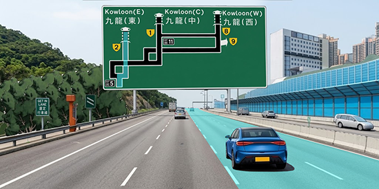
Right Figure: Keep right at the diverging point for "Kowloon (E)"
Speed Map Panels (SMPs) are installed in the New Territories at critical diversion points of strategic routes to Kowloon. Using simplified schematic diagrams to display a wider road network, they provide motorists with real-time traffic conditions and estimated journey time.
Each set of SMP consists of a series of speed map display and journey time indicators. Three sets of the SMPs are now installed at New Territories East while two sets are installed at New Territories West. Motorists can make use of the real-time information to choose the most appropriate routes.

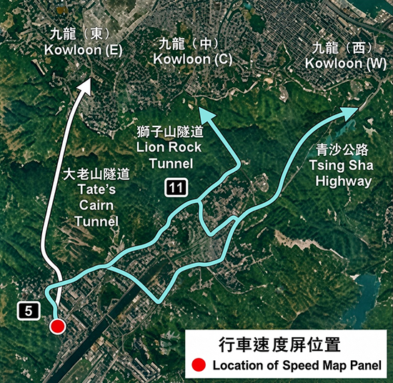
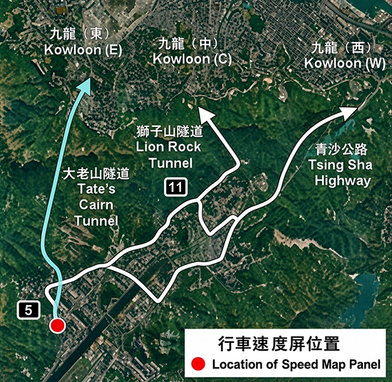
Taking the SMP on Tate's Cairn Highway southbound near Shek Mun as an example, based on the overall layout of the road network, "Kowloon (E)" is shown on the left side of the panel, while "Kowloon (C)" and "Kowloon (W)" are shown on the right side (the positions of the destinations on the panel do not directly correspond to the individual traffic lanes on-site). The bottom-left corner of the panel represents the motorist's current location ahead of the diverging point at "Exit 5": after referring to the real-time traffic conditions on the panel, motorists may choose to keep left at the diverging point for "Kowloon (C)" or "Kowloon (W)" (see left figure); or keep right for "Kowloon (E)" (see right figure).
|
|
|
|
Left Figure: Keep left at the diverging point for "Kowloon (C)" or "Kowloon (W)" |
Right Figure: Keep right at the diverging point for "Kowloon (E)" |